Disappearing Forests
Millions of forest trees are disappearing every year. The investigative journalism program "Digital Eye" uses the power of digital technology to unravel the reality of the deforestation process.

Transcript
August 2023, Canada.
Smoke billowing in the air...
Raging flames...
The beautiful nature was completely scorched.
It was very apocalyptic. It was devastating for us.
Not only in Canada, but in other parts of the Northern Hemisphere, including Siberia and Alaska,
many forests are facing a growing fire crisis.
There's an issue near the Equator as well.
In Borneo, in Southeast Asia, tropical rainforests are being cleared and plantations are spreading.
Every year, 4.7 million hectares of forests continue to be lost.
But, because of the sheer size of the forests,
up to now it's been difficult to grasp the whole picture.
Today, however, using the power of digital technology,
there's a movement to capture the entire status of forests from various angles.
A system launched by an NPO in the US
grasps what is happening in forests around the world by commanding a bird's-eye view.
There was just a lot of excitement because again,
it was the first time that there was a data set that could monitor for us at scale across the globe.
Climate change researchers are trying to solve the mystery of smoke rising from the ground.
Using a digital eye, they have captured its occurrence.
It has a very unique condition and those are potential zombie fires.
Using satellites, land survey researchers have taken on the challenge of investigating erosion in northern regions.
Satellite analysis can capture slight changes on the surface of the Earth.
If we had satellite images all the time, I think we'd be able to find a lot of signs
of phenomena we don't know about yet, or deformation of the ground around them.
The task of water cycle researchers is to clarify the effect of tropical forest destruction.
Using supercomputers, they've revealed impacts beyond our imagination.
Digital satellite data is incredibly important.
Without it, we wouldn't have the discoveries we have today.
The disappearing great forests and the serious changes being caused on a global scale...
The power of digital technology brings us closer to the reality of this situation.
In recent years, large-scale forest fires have been occurring in the boreal forests of Canada.
The total area burned in 2023 amounted to 18.5 million hectares, roughly half the size of Japan.
This was the worst case ever in Canadian history.
Kelowna is in British Columbia in Western Canada.
Coniferous forests spread around the city of 150,000 residents.
Here, too, a large forest fire broke out in August 2023.
The fire spread in a short time and caused a lot of damage.
Data from that time shows how the fire spread.
On the second day, the fire was limited to a small area.
On the third day, it expanded about two kilometers to the northeast.
At this point, it was not expected to grow any bigger.
On the fourth day, however, the fire suddenly spread at a rapid speed and engulfed the city.
It resulted in one of the largest-scale fires in Kelowna's history.
Jeffery Findlay lost his home in the fire.
I didn't think this would happen.
I thought it might burn, but I didn't think it would burn so badly.
Findlay's home was located right next to the forest.
He runs a ranch and a horse riding club.
We're at my place, and I could feel the heat coming off the mountain.
You could hear it. It was growling.
It was not like crackling fire.
It was a growl. It was like a monster.
Like, I would equate it to maybe a rolling wave or the crashing sound of a wave.
It was growling and it was rolling and moving.
The fire continued to burn for a month, destroying 13,500 hectares of forest.
What is behind the expansive spread of forest fires?
Brad Litke led the firefighting team.
We were dealing with a lot of drought conditions.
So it was, it was very dry and we hadn't seen rain,
particularly in that part of the area of this region.
So cause for concerns.
Any then you couple that with a wind event that was forecasted
to have such high winds come into that part of our region, into the Okanagan Valley.
What triggered the fires this time were the dryness and strong winds
that had not been seen previously.
In recent years, fires in Canada are believed to have become more extensive
as a result of these environmental changes.
We're starting to see very strong reaching patterns through the province
which bring long periods of hot, abnormally hot, dry periods,
exacerbates the drying of our forest fuels and makes them available to burn.
There is an urgency to manage our forests differently.
And there is an urgency to address the increasing risk.
The state is now introducing a system that uses satellite data
to monitor the occurrence of fires in real time.
The green marks are fires that are currently burning, but have no potential to spread further.
The red lines indicate the areas recently burned by fire.
Red marks indicate places where the fire is spreading because firefighting can't keep up with it.
As forest fires become more serious,
the introduction of systems to monitor the situation is being considered in many regions.
In 2014, a revolutionary system was created in the United States.
It visualizes forest status on a global scale.
This is the World Resources Institute, or WRI, in Washington, D.C.
WRI is a non-profit organization established by research institutes and companies from around the world.
It conducts research on global environmental and forestry issues.
It was here that Global Forest Watch was created.
Commonly known as GFW, the system visualizes the status of the world's forests
based on satellite data collected from all over the world and statistics from various countries.
It allows us to see at a glance how much forest has been lost so far.
The areas shown in red on the map have suffered tree cover loss since 2001.
We can also find the reasons why the deforestation occurred.
For example, in the case of Africa, including logging concessions, and mining concessions,
it's possible to choose from as many as 15 settings.
A lot of that information was just available in reports or in formats
that were not easily accessible to the public.
And that meant that people were really in the dark about what was happening with forests.
It's very helpful to use a tool like Global Forest Watch to monitor and understand forests
because forests are just such a vast and often remote resource
that without using technology it's difficult to fully monitor them.
This map indicates locations that have been destroyed by fire.
Such destruction is spreading, mainly in the Northern Hemisphere and near the Equator.
About 30% of forest loss is caused by fire.
So when we're looking at our "tree cover loss from fires" product,
we can see that there's actually twice as much forest
that is burned across the globe as was happening about 20 years ago.
But what we're finding is that the fire seasons are becoming more intense and longer,
and that means that the forests are burning more than usual.
Of all the countries affected by forest fires over the last twenty years,
Russia has suffered the most damage.
Russia boasts the world's largest forest area.
In particular, Siberia has vast forests of coniferous trees called 'taiga.'
In the summer of 2021, the forest-rich nation suffered a fire of an unprecedented size.
The fire broke out around May and expanded rapidly in late June.
A state of emergency was declared, military aircraft were dispatched,
and 2,000 people were involved in firefighting activities.
By the time the fire was extinguished in October,
the total area of forest burned was 18.8 million hectares.
That's about half the size of Japan.
Local media reported it as the worst forest fire for a quarter of a century.
Social networking sites were filled with comments from frightened local people.
They all want to move out of here. We can't live here anymore...
President Putin also became increasingly concerned about the situation,
declaring that he would contribute more than 325 million dollars to the cost of countermeasures.
In light of the damage caused by this massive fire,
the forest management system must be further strengthened.
We've decided to spend 24 billion rubles more on countermeasures.
Isaev Alexander Petrovich, a forester living in Siberia, where the fire broke out,
was shocked by the unprecedented situation.
2021 was an extraordinary year in terms of forest fires.
In the Sakha Republic in northeastern Siberia, over 9.4 million hectares burned.
Smoke obscured the sun and it was a very disturbing sight.
Forest fires have been recorded since 1955,
but I don't know of any fires of this magnitude.
This major Russian fire that occurred in 2021 was also captured by a NASA satellite.
The orange dots indicate the fire.
From there, light brown smoke spreads throughout Russia.
It was observed to have reached the North Pole, approximately 3,000 kilometers away.
Sometimes the smoke crosses the country and travels downwind to faraway places.
It eventually reaches Japan, for example, and we call that 'transboundary air pollution.'
Associate Professor Yasunari Teppei at Hokkaido University studies air pollution in the Arctic and other cold locations.
This data shows the movement of air pollution in 2014,
as analyzed by Yasunari and his international research team.
At the top is Siberia, and the white dot on the lower right indicates Sapporo in northern Japan.
The large red and green area shows high concentrations of Particulate Matter, or PM 2.5, caused by forest fires.
It reaches as far as Sapporo.
PM 2.5 is identified as a health hazard.
This case of transboundary air pollution was the first instance of Sapporo City
issuing an alert since it began measuring pollution.
It really is transboundary, isn't it?
It's transported to downwind areas.
When forest fires occur, we can see air pollution spread like this.
Digital technology is now revealing the previously unknown mysteries of forest fire outbreaks.
Oymyakon is a small village in Eastern Siberia.
It's known as the coldest inhabited place in the world.
About 500 people live here, where the average temperature in January is 50 degrees below zero.
On the other hand, in the short summer months, the temperature can exceed 30 degrees Celsius,
making this a place of extreme temperature differences.
A phenomenon witnessed in this village has attracted worldwide attention,
with more than 120,000 views on social media.
It occurred after the forest fires had subsided.
White smoke can be seen rising from a corner of the snowfield.
And it's happening in more than one place.
The holes where the smoke is coming from appear to be melting with the heat.
The phenomenon was filmed by local photographer Semen Semenovich.
It was a very cold day. The temperature was about 50 degrees below zero.
I was very surprised to see smoke billowing up!
Smoke of unknown origin rising from the extremely cold and snowy ground.
What could be the reason?
Using satellite observation data, a researcher is trying to solve the mystery.
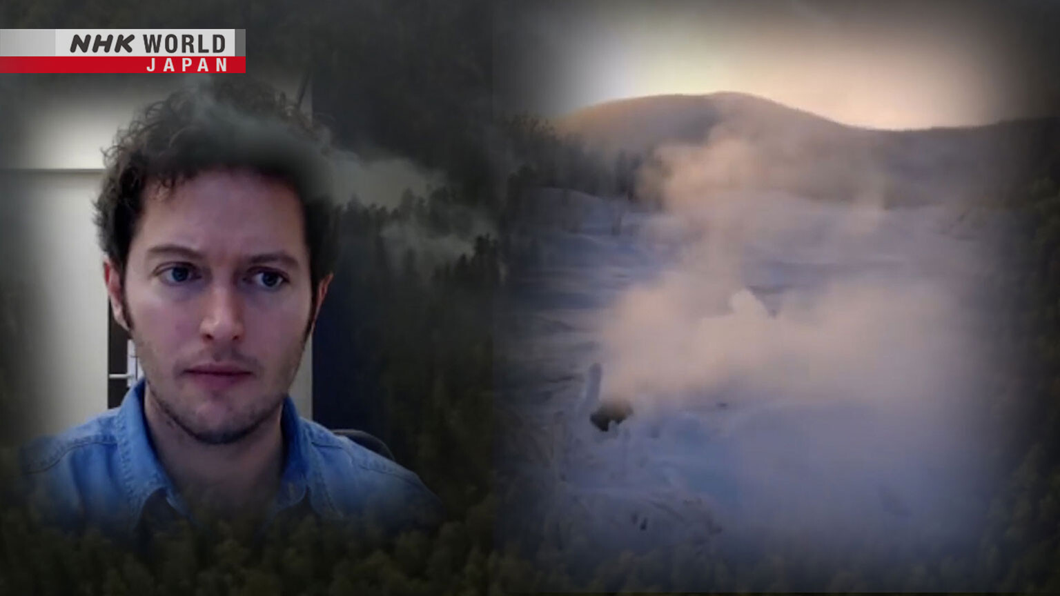
Dr. Sander Veraverbeke, a researcher in Amsterdam, specializes in climate change and ecosystems.
He is researching what effects climate change will have on forests.
The first video really looks like what we have been researching as an overwintering fire,
a 'zombie fire' in the forest, because you can clearly see the forest.
It's possible that one of these smoldering zombie fires can flare up again and start spreading again,
just like it would be a new forest fire.
A zombie fire...
Veraverbeke had captured a similar phenomenon using satellite data.
When he was checking the data on the 2015 fires in Alaska, he discovered zombie fires.
I kept looking at the satellite data like a year later
and what I saw is that like in the spring, one year after these big fire years,
I could see at the edges of the fires' scars I could see like several fires in spring.
I could see like flaming, flaming up in the satellite data.
And to me that was very strange.
This satellite image from that time shows an area 15 kilometers long and 12 kilometers wide.
The land surrounded by white lines indicates the area burned by the forest fire.
April, six months after the fire.
The light blue represents snowfall.
It's clear that snow has accumulated all over the area.
And then in May, after the snow melted, a number of new fires broke out.
They were caused by fires that had been smoldering underground for about six months reappearing above ground.
They are called 'zombie fires.'
This is the mechanism.
When a large fire breaks out in the northern forests,
small bits of fire can spread inside the soil.
In the soil, there are mosses and dead plants that remain undecomposed,
and it is those that catch fire.
In winter, the soil is covered with snow, so even if it rains,
the snow acts like a big umbrella to stop the rain from quenching the fire.
Then, in spring, when the ground surface becomes dry,
the fire spreads above ground by moving along tree roots, etc.
Resurrected like a zombie from underground, it spreads as a new forest fire.
Furthermore, based on the fire statistics,
Veraverbeke has discovered certain specific patterns of zombie fires.
Based on these statistics, we can then set up our algorithms.
So this early in spring, within 50 days after the snow melts,
it is like I think it was the definition was around within one kilometer of the old fire scar...
I think the sheer fact that this is happening shows us how dramatically
these forests in the high latitudes are changing and the fires are changing.
And so the more area that you burn and the more severe,
the more deeper in the soils you burn, the higher the likelihood of a zombie fire.
Veraverbeke predicts there will be zombie fires again this year.
You can expect that some of these fires from Canada in 2023
will flare up again in 2024 as zombie fires.
That's, well, a minority of the fires from last year survives winter and will burn again in spring.
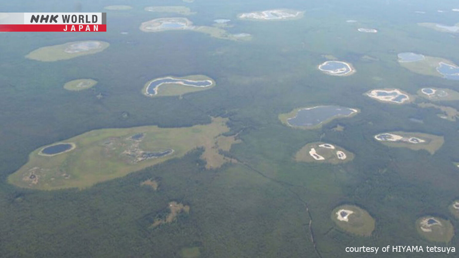
This photograph taken in the boreal forest area shows what appears to be worm-eaten holes.
In fact, the strange sight is believed to be closely related to the global loss of large forests.
Professor Furuya Masato of Hokkaido University,
uses satellite data to measure changes in the Earth's surface on a global scale.
The Japan Aerospace Exploration Agency's Advanced Land Observing Satellite
can observe the undulations of the earth's surface in centimeters from space.
The satellite captured this image in Siberia.
Red indicates places where the ground has sunk by three centimeters.
The image shows an area of sunken ground as large as 3,600 hectares.
We didn't know what was going on at first, but based on our experience
it was clear that we were seeing deformation of the Earth's surface.
Furuya reviewed images of the earth's surface taken by another satellite.
He spotted white smoke rising from the forest.
It stretches from the center of the image to the upper right.
I was convinced it was a fire.
Heat causes frozen ground or ice to melt. It triggers a change in the terrain.
It's commonly referred to as 'thermokarst.'
This subsidence phenomenon is called thermokarst.
This is caused by permafrost, a type of frozen ground unique to the boreal region.
Permafrost is protected from the sun's heat by forests.
However, if a fire breaks out and the trees burn down...
...the black soot, burnt branches, and other materials remaining on the earth's surface can easily absorb the sun's heat.
Heat travels into the ground and the permafrost begins to thaw.
And for the amount of permafrost that is thawed....
...the surface sinks and subsidence occurs.
That is thermokarst.
Thermokarst occurs in conjunction with forest fires...
Professor Furuya points out its expansion.
Both the scale and area of forest fires seem to be getting bigger and bigger,
so we'll see more and more of the same kind of fire-originated thermokarst.
It's also believed that the expansion of thermokarst can cause further deforestation.
According to Professor Hiyama Tetsuya of Nagoya University, who studies the global environment...
The forests continue to decline as the ground sinks.
It's only in very limited areas, but water collects in the low parts,
and the trees submerged in the water die.
As the trees disappear and temperatures rise, the permafrost thaws further.
The subsidence then gets deeper, larger, and more prone to pooling water.
It eventually becomes a swamp, and it becomes difficult for trees to grow there again.
Once thermokarst occurs, it will not stop expanding but continue to do so for hundreds or even thousands of years.
The edge of the swamp is very prone to solar radiation in summer,
so the ground ice in the permafrost melts.
As the ice melts, the area sinks from above, or the soil on top of the ice falls.
This kind of slope is created as a result.
This photo shows bare, crumbling soil engulfing trees.
Thermokarst has been identified not only in Siberia, but also in other parts of the boreal forest.
Global warming has also been pointed out as a factor behind its expansion.
In fact, all the forests of Siberia are believed to be revitalized by global warming.
This diagram shows the data of temperature changes in the whole Siberian region.
It compares the average for the decade around the 1980s with the decade of the 2010s,
and shows where the differences are large.
The darker red shows areas where global warming is progressing.
The following diagram shows the changes in the degree to which plants are actively growing.
The darker the green, the more revitalized the foliage is compared to the 1980s.
The comparison of these two diagrams shows that the activity of leaves
is increasing in areas where global warming is accelerating.
However, at the same time, there is also a warming effect in the ground and so thermokarst is spreading more and more.
On a fairly broad scale, the forest zone could expand
in the form of, for example, moving northward.
At the same time, however, forests easily die off due to global warming,
and that's more of a problem.
While global warming has been stimulating forest revitalization,
it has also been causing deforestation due to thermokarst.
Forest fires have a variety of impacts.
Associate Professor Yasunari Teppei of Hokkaido University
is working on more detailed measurement of the air pollution caused by forest fires.
This is a newly developed device that measures air pollution, such as PM 2.5.
It's designed to operate throughout the year,
even in extremely cold regions where temperatures have previously been too low for measurement.
We want to have the data so that we can always grasp the situation.
We're thinking of using the device to assess the respective fires,
the air pollution in that area, or things like that,
in Greenland, the Arctic, Alaska, and other areas.
Through a series of air pollution studies,
Yasunari discovered a factor that may be behind the frequent occurrence of forest fires.
It's an unusual pressure pattern.
Together with an international research team,
he studied the pressure pattern data of several decades
in order to analyze the movement of pollutants during the summer months.
He used a massive data set called NASA's MERRA-2 that has accumulated all kinds of information
about the Earth's atmosphere since 1980, including temperature and wind strength.
This is a view of the earth from just above the North Pole.
Yasunari averaged the pressure patterns for the summers from 1980 to 2002.
High and low pressure systems are aligned in a straight line from Western Europe to Russia.
This was the same as the arrangement known so far.
On the Eurasian continent from 1980 to 2002,
the blue and red marks are aligned in a straight line.
But for the period after 2003, they're not aligned in a straight line.
Looking at the 15 years from 2003, which Yasunari has focused his attention on,
the high pressure system was arranged in a ring around the North Pole.
This pressure pattern has been seen especially in recent years.
Yasunari's analysis suggests that heat waves, drought, and forest fires may occur in areas
from Western Europe to Siberia, Alaska, and Canada covered by high pressure.
If there is a heat wave and there is a forest or some other ignition source
fires will naturally occur there.
This means that forest fires are more likely to occur
in places like Siberia, Alaska, and Canada around the same time.
Yasunari and his colleagues named this pressure pattern encircling the North Pole
as the CircumArctic Wave Pattern, or CAW pattern.
However, there are many unknowns,
such as the relationship with global warming and how often the CAW pattern will appear in the future.
If this is understood, there is the possibility that we'll be able to
more accurately predict the phenomena I've just described,
such as simultaneous heatwaves in Europe, Siberia, Alaska, and Canada.
Research that uses digital technology to view forest fires from the larger perspective of the atmosphere
and climate is now attracting attention around the world.
Deforestation is occurring in many parts of the world.
Northern regions have been severely affected by fires.
Global Forest Watch showed that tropical forest decline was also occurring near the Equator.
Deforestation is notable in Southeast Asia, especially in Borneo.
Mongabay has been covering environmental news for more than 20 years.
Mongabay is an environmental news platform with five million users worldwide.
It reports on what is happening in forests around the world.
Morgan Erickson-Davis is the senior editor.
She's concerned about the tropical rainforest deforestation caused by tree logging.
Yeah, well, their situation is complex in the tropical areas, and it's varied.
Different tropical areas are subject to different human pressures.
Industrial agriculture is really common in many South American countries as well.
In South America, it tends to be soy plantations.
Also, cows are a big problem in Brazil.
That's getting expanded as well.
In Southeast Asia, particularly Borneo.
Logging was a big problem in Borneo for decades and decades historically.
And that continues to be the case.
The island of Borneo in Southeast Asia.
It has tropical rainforests blessed with a diversity of flora unparalleled in the world.
However, unnatural deforestation has been continuing for decades.
This image data shows the forests of Borneo in 1973.
The green area was forest that covered 76% of the island.
However, in 2010, the pristine forest areas represented by dark green
had been reduced to only 28% by logging.
In just 40 years, the forest has been reduced by half.
The landscape of the island has totally changed because of oil palm plantation development.
Palm oil is in growing demand worldwide for uses ranging from cooking oil to biomass fuel.
In response to global demand, the rainforests in Borneo were transformed into farmland.
What will happen in Borneo with the loss of its rainforest?
Professor Kumagai Tomo'omi at the University of Tokyo studies the relationship between forests and water.
He's been conducting research on the island for many years.
Apparently, the loss of the rainforest is causing serious changes throughout the island.
I think the biggest issue is the water vapor in the atmosphere.
If deforestation continues, the rainfall will decrease along with it.
The decrease in precipitation is a serious issue.
According to this graph of the average annual rainfall on the island,
it has decreased by 600 millimeters over the past 60 years.
We don't know if the rainfall has decreased because of the forest loss.
There may be other factors, so I wanted to do a calculation
to see what would happen to the rainfall if Borneo's forests were actually destroyed.
If deforestation is total, what happens to the rainfall?
Kumagai used a supercomputer to simulate such an extreme situation.
This data reproduces the amount of rainfall during one month in Borneo.
The darker blue indicates more rainfall.
In the calculation for the case where all the tropical rainforest is cut down,
the blue part indicating rainfall has drastically decreased.
As expected, we could confirm that rainfall is reduced as a result of deforestation.
But, more than that, the mechanism of how it happens has become clear.
One factor is 'evapotranspiration.' When forests are destroyed,
evapotranspiration is reduced, which means less rain.
So what is the mechanism of evapotranspiration?
Moist air comes to the forest and produces rainfall.
Water droplets on leaves and branches evaporate,
and the water soaked into the soil is sucked up by the roots and evaporates through the leaves.
This is how it works.
The moisture returned to the atmosphere due to evapotranspiration
is moved by wind and other factors, causing rainfall.
In this way, the presence of forests allows evapotranspiration to be repeated and moisture to circulate.
Without the forests, however, when it rains,
the moisture flows out of the soil to different locations and no evapotranspiration occurs.
This could be a possible reason for the decrease in rainfall in Borneo.
Furthermore, in his research, Kumagai discovered a surprising forest power.
What I had not expected at all was that, thanks to the presence of forests,
the energy coming from the sun was effectively used
to evoke the movement of the air,
which actually attracted water vapor from the ocean to the forests.
This graph compares the air convection strength
when the evapotranspiration power of the forests in Borneo is restricted,
and when all the forests are cut down.
When the entire forest is cleared,
the graph showing air convection strength extends downward.
In other words, it has been greatly weakened by logging.
On the other hand, when the evapotranspiration power is reduced,
the air convection strength is greatly enhanced.
This showed that as long as there is a forest,
a strong convection is created and air is drawn in from the surrounding area.
Kumagai believes that this wind-generated air convection brings new rainfall to the island.
This is how it works.
The forests are constantly flooded with energy from the sunlight.
The forests store the energy and then use it to heat the air above.
Then a strong air convection is created, which heads toward the sky.
It's an updraft.
The updraft draws air containing large amounts of water vapor into the island from the nearby ocean.
That creates clouds and rain falls.
The presence of forests is said to create this atmospheric convection.
Thanks to the forest, air containing moisture can be drawn in to produce rain.
The fact there's a forest is actually important.
It's vital to have something green there.
I've learned that the power of the forest is not what I thought it was.
It's something much more powerful and amazing than I expected.
Digital research has revealed the power of forests.
They contribute to creating the environment for extensive areas,
such as an entire island or even a continent.
In the field of forest fires, new initiatives are still required to reduce the spread of damage.
So when we think about the future and solving the climate crisis,
wildfire management is actually a quite a critical piece of that puzzle.
And there is an urgency to manage our forests differently.
And there is an urgency to address the increasing risk that the public at large
and values and stakeholders across the landscape face due to wildfire.
In Canada, an AI-based forest fire monitoring system has been introduced.
This system predicts the occurrence of forest fires on the following day.
The Alberta Forest Protection Areas are shown here.
Red means a high fire risk throughout the day.
Yellow is where the risk increases in the afternoon.
And blue shows where the risk is low.
Moreover, the system can even display the probability of a fire occurring.
In an area indicated as "high level" in the northern part of the state,
it was predicted that a fire would occur in the afternoon of the following day with a probability of over 80%.
This data is being used for early firefighting planning, including the assignment of firefighters.
It's one tool in the suite of toolbox to help make decisions.
And so I think anything that kind of helps people to be able
to make those decisions and feel confident about that is, is really big.
AI underpins this system.
It learns the characteristics of forest fires
that have occurred in its jurisdiction within the past 15 years,
weather forecast data, and information on forest ecosystems.
AI is an incredibly powerful sort of paradigm or emerging technology.
I think it will have a very valuable role in sustainability, and global sustainability in general,
and forestry being a part of this, right, and forest management and wildfire management.
Digital technology is gradually unraveling the status of forests.
What has come to light is the ways forests shape the environment on a global scale.
Trees and forests are important living beings in creating the global environment.
With satellites, we can now observe the entire planet.
Digital satellite data is incredibly important
because it allows us to obtain data on places that are not easily accessible.
Without it, we wouldn't have the discoveries we have today.
Understanding forests leads to understanding the Earth itself.
The status of forests cannot be fully grasped by the human eye,
so it's vital to continue looking at them making full use of digital eyes.