#31 Lava Flow
The 1983 eruption of Tokyo's Miyake Island resulted in the burial or loss of approximately 400 houses as well as a school built of reinforced concrete that was also buried by lava flow. The hazard map for Mount Fuji was revised in 2021, revealing the possibility of far greater damage from lava flows. Why have the damage assumptions been increased? And what countermeasures should be taken? In this episode, we'll look at the latest research on lava flows from Mount Fuji.
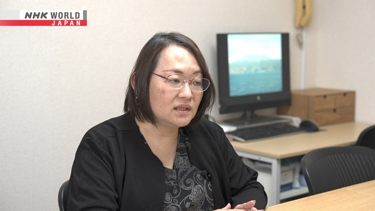
MIYASHITA Kana lost her home due to the 1983 lava flow on Miyake Island.
Reporter: Lemi Duncan
In 2021, the hazard map for a possible eruption of Mount Fuji was revised, anticipating lava flows to arrive sooner and cause far more extensive damage.
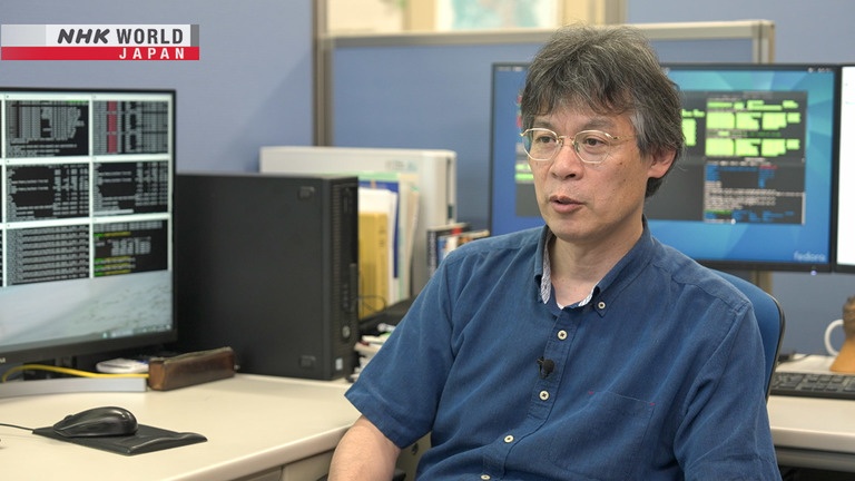
Dr. Eisuke FUJITA of the National Research Institute for Earth Science and Disaster Prevention has been conducting research on lava flows from a possible eruption of Mount Fuji. He has developed a unique hazard map that shows the movement of a possible lava flow every 10 minutes, making it possible to identify safe evacuation routes.
Transcript
Japan has a long history of natural disaster.
Now, the power of science is helping to overcome them.
BOSAI: Science that Can Save Your Life.
This is lava erupting from a crater,
and flowing at a high temperature of more than 1,000 degrees Celsius.
Lava flows can alter the terrain, cause enormous destruction, and endanger people's lives.
Volcanic eruptions can cause a variety of dangerous materials to be ejected,
including volcanic ash, cinders, scoria, and pyroclastic flows of gas and rocks.
Lava flows, which burn forests and swallow villages in their path,
are particularly dangerous and can have a big impact on the lives of local people.
In this program, we'll investigate the threat of lava flows and measures that can be taken to protect ourselves against them.
In October 1983, an eruption on Miyake Island, a volcanic island located south of Tokyo, released a large amount of lava.
The lava flowed towards the village in the Ako district in the southwest of the island.
In just one night, about 400 houses were burned and buried by lava.
Residents watched this happening on a TV screen at the evacuation center.
This is Miyashita Kana, who watched her house burn down from the evacuation center.
She was a junior high school student at the time.
What was it like when
the lava flow approached?
The eruption started at 3 pm
and evacuation was completed by 5 pm.
30 minutes later, the houses near the
top of the mountain were burning.
At 7 pm, I saw on TV that the area near my house
was on fire and covered in lava.
Seeing it buried under lava, I thought
I'd never be able to go back there.
The residents had been evacuated, so there were no casualties,
but the lava flow reached the village just two hours after the eruption.
The terrain was also altered.
It was extremely difficult to remove the solidified lava,
and even now, almost the entire area remains affected.
What are the dangers of a lava flow?
It burns everything in an instant and buries it.
I returned to the area a week later,
but it was so hot that I couldn't get near it.
The lava's temperature is so high that
you wouldn't survive if it hits you,
which is frightening.
Japan is a land of volcanoes,
and there are many places where the danger could be even greater than what happened on Miyake Island.
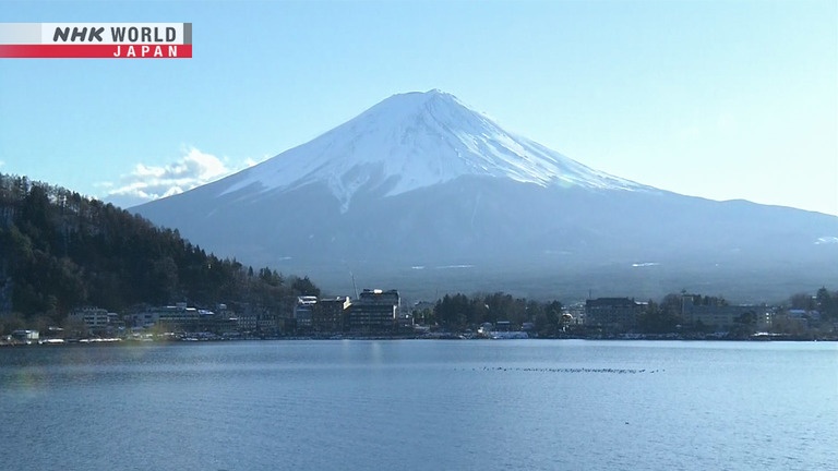
The most well-known volcano in Japan is Mount Fuji.
This mountain, which is a famous World Heritage Site, is also a volcano that has erupted repeatedly since ancient times.
In 2021, the hazard map was revised,
and it became clear that the damage caused by lava flows could be much more extensive than previously thought.
This map shows the previous predicted extent of lava flows, which remained relatively close to the mountain.
However, when the predictions were revised in 2021,
it was found that they might reach as far as populous Kanagawa Prefecture, which is about 25 kilometers from the crater.
The number of people to be evacuated increased almost 10-fold, from about 16,000 to about 116,000.
If Mt. Fuji erupts, the lava flows are predicted to spread over a wider area than had been previously thought.
What is the latest research that caused the prediction to be drastically revised?
I visited the National Research Institute for Earth Science and Disaster Resilience.
Dr. Eisuke Fujita, who was involved in the revision of the Mt. Fuji hazard map,
studies the mechanics of volcanic eruptions.
Why did the predicted range of
lava flows from Mt. Fuji increase?
We did a lot of new research on how much lava
was released by past eruptions of Mt. Fuji.
For example, the Jogan eruption in 864 occurred
at Aokigahara Forest on the northwest side.
We found that the amount of lava released
was about twice as much as previously thought.
The Jogan eruption in 864 is the largest known eruption of Mt. Fuji.
The amount of lava released was previously thought to be 700 million cubic meters.
However, the latest study found that there were actually 1.3 billion cubic meters.
The number of craters has also exceeded previous assumptions.
In addition to the crater on the summit of Mt Fuji, there are also other craters on its sides and at its foot,
and eruptions have occurred from various places.
This map shows the unevenness of the ground surface.
We can see that craters from past eruptions can be found all the way to the foot of the mountain.
There were previously thought to be 44 such craters,
but the latest survey found that there are 252, about five times as many!
This is Gotemba, a city with a population of about 85,000, at the foot of Mt. Fuji.
According to the previous predictions, a lava flow could arrive 10 hours after an eruption.
However, it is now thought that if an eruption occurs at a nearby crater,
the lava flows could reach the city in just two hours.
Lava flows could engulf the Tomei and Shin-Tomei expressways, in as little as 2 to 3 hours,
and even the Tokaido Shinkansen could be cut off in 5 hours.
What measures can we take on a personal level?
We provide hazard maps
using the latest technology.
Lava generally flows about
as fast as a person can walk or cycle,
so I think we can save lives.
This is a lava flow hazard map developed independently by Fujita.
It simulates lava flows from each of the 252 craters, depending on the size of the eruption.
The 10-meter-mesh map shows the movement of the lava flow every 10 minutes, making it possible to identify each path.
This information can be used to achieve a safe evacuation.
The estimated damage caused by a lava flow from an eruption of Mt. Fuji has been significantly revised.
Various measures are now being taken by local governments in areas that are expected to suffer damage.
This is Susono where about 50,000 people live.
31 craters, including some within the city area itself, were found to pose a lava flow hazard to the city.
This is Yamamoto Yasuo, who is in charge of crisis management in Susono.
He was initially surprised by the change in the city's situation.
According to the previous hazard map
it would have taken a day to reach
parts of the city along the mountain.
The new hazard map shows that
it could take only half a day
to run through the city along the river.
This is a lava flow visualized in 3D, based on the hazard map.
In the fastest simulation, the lava flow reached the areas of the city with tourist facilities such as the safari park,
and densely populated areas where junior high schools are located, in just 50 minutes.
Finally, it reached the city hall, 15 kilometers away from the crater.
With this in mind, the challenge is to ensure a safe evacuation.
According to the Mt. Fuji Volcano Disaster Management Conference, if Mt. Fuji erupts, people should evacuate on foot.
This is to prevent cars causing traffic jams, which would delay the evacuation.
However, in Susono, where craters are located within the city,
there may be elderly people and children who cannot evacuate without using a car.
It is difficult to predict how much traffic congestion would occur if people evacuated by car.
It was a major automobile manufacturer in Susono that helped find the answer to this question.
This is Kitahama Kenichi, who works on traffic congestion prediction.
He used the company's traffic jam prediction simulation technology.
What kind of data are you using
to make this simulation?
We use data held by the government about
where people live and how many there are.
Using this data and questionnaires,
we can understand patterns of evacuation behavior.
We ran a simulation for a time with the most cars:
lunchtime during the Obon holidays in August.
This is a simulation screen that calculates whether traffic jams will occur if people evacuate all at once by car.
The area near the crater is called the Suyama district, where tourist facilities are located.
Vehicles are displayed in different colors depending on whether they are residents or tourists.
In addition, five intersections where traffic congestion is likely to occur are enlarged.
Let's see what happens.
30 minutes after the start of the evacuation, the first traffic jams occurred near the safari park.
And one hour later, traffic jams occurred in the Suyama district.
This is the area a lava flow could reach in under 2 hours.
But it took about 3 hours for the congestion to clear.
This shows that it would be extremely difficult to evacuate by car after an eruption.
On the other hand, this is an area designated as an evacuation site.
The traffic from the Suyama district gradually reduced,
and after six and a half hours, the evacuation had been completed.
Understanding the movement of vehicles during an evacuation will be useful for future evacuation planning.
Using these simulations, we can see
the location and amount of traffic congestion.
For certain intersections, you could
impose restrictions to improve traffic flow,
or control the traffic lights.
We are in discussions with the government and police
to see if we can improve traffic flow.
Discussions are currently underway on how to make evacuation by car smoother,
and Susono has decided to evacuate vulnerable areas such as the Suyama district first.
In preparation for an unpredictable eruption of Mt. Fuji,
the public and private sectors are working together to protect people's lives.
Mt. Fuji was formed by repeated volcanic eruptions and lava flows.
If it erupts again, the lava flows could be catastrophic.
However, the latest research and initiatives have shown that it is possible to evacuate safely.
If you are in an area near an active volcano, it is very important to understand the risks.
Please also be sure to check a hazard map in order to know where to evacuate.