#23 Typhoon Forecasting
More than 10 typhoons hit the Japanese archipelago in an average year. Their strong winds and heavy rains can cause flooding and landslides, even toppling buildings. To minimize such damage, Japan is working to further improve its predictions and monitoring of typhoon activity. But, accurately predicting a typhoon's changing strength is particularly challenging. To address this, researchers now fly a plane into the eye of a typhoon to measure the actual atmospheric conditions directly on-site. In this episode, we learn more about flying into these fierce typhoons.

Transcript
Japan has a long history of natural disasters.
Now, the power of science has helped it to overcome them.
BOSAI
Science that Can Save Your Life.
Tropical cyclones in the Northwest part of the Pacific Ocean: typhoons.
Their torrential rains can flood rivers and trigger landslides.
Their strong winds can topple buildings.
To counter this threat, Japan is constantly improving its typhoon forecasting tools and techniques.
But predicting typhoon activity can be quite a challenge.
Sometimes typhoons expected to cause a lot of damage actually weaken before making landfall.
On average, 11.5 typhoons approach Japan each year, often making landfall and causing significant damage.
Given their potential for destruction, improving typhoon forecasting is clearly a topic of vital importance.
With new approaches, research is underway to help better anticipate the inscrutable behavior of typhoons.
On today's program, we'll look at some of the new techniques being used.
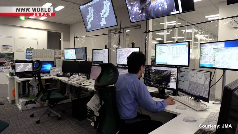
First, we visited the Meteorological Agency, Japan's sole publisher of official typhoon forecasts.
Hello. Thank you for your time today.
Yoshimatsu Masayuki specializes in typhoon forecasting here.
We often hear that predicting typhoon activity
is extremely difficult. Could you tell us why?
There's still a lot we don't know
about how typhoons develop, especially when they develop suddenly.
That certainly makes them difficult to predict.
So, how do typhoons first form, and then grow?
This shows the paths of all typhoons and tropical cyclones from 1985 to 2005.
We can see that they mainly occur over the sea near the equator.
The warmer waters south of Japan
produce a lot of humidity.
When that water vapor becomes clouds and those
clouds start rotating, that's how a typhoon forms.
Warm water vapor, lighter than the surrounding air, rises, forming clouds.
The lower atmospheric pressure in the center then pulls in more water vapor from the surrounding area.
The rotation of the Earth then causes this formation to begin to spin.
This cycle produces a growing vortex that eventually becomes a typhoon with strong winds and heavy rain.
But how can changes in typhoon activity be predicted?
We were given a special look behind the scenes.
This room monitors the formation of tropical cyclones around the clock.
When a typhoon approaches Japan, the agency publishes a 24-hour typhoon tracking forecast, updated every three hours.
These screens show the information
we use to forecast typhoon activity.
It looks like a lot of information.
This pink line shows the typhoon path
predicted by the supercomputer.
It's calculated based on the paths of previous
typhoons, varying environmental conditions, and how much the possible paths diverge.
The supercomputer's predictions take several atmospheric factors into account, including: temperature, pressure, humidity, and wind speed.
This is the agency's predicted path for Typhoon "Nanmadol" in September 2022.
When we overlay the actual path taken by the typhoon, we see it's very close to what was predicted.
Supercomputer performance is always improving, which is reflected in increasingly
accurate predictions of typhoon paths.
But not as much for predictions of typhoon
strength, which seem to be more challenging.
Predicting a typhoon's changing strength is harder than predicting its changing course.
For example, Typhoon "Haishen" in September 2020.
It was expected to strike the island of Kyushu with 'exceptional strength,' and residents were urged to evacuate immediately.
But when it actually arrived on Kyushu, it was significantly weaker.
Even with modern science, it's hard to know if a typhoon will strengthen or weaken.
Today we are at Nagoya University, groundbreaking research is underway, to better predict the strength of typhoons.
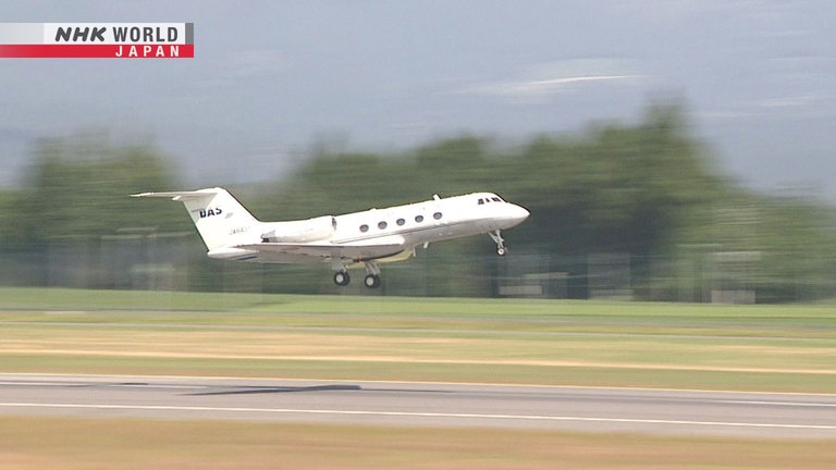
They've even ridden a plane into the eye of a typhoon to acquire more precise data.
Let's learn about the ideas behind this research.
Hello. Thank you for meeting with us today.
Thank you for visiting.
Professor Kazuhisa Tsuboki is a leading typhoon researcher.
He collects his data on-site, flying into typhoons to measure atmospheric conditions directly, in the eye of the storm.
I hear you fly directly into the eyes of typhoons
to collect data. Why go to all that trouble?
In a huge typhoon, the eye is tens to hundreds of
kilometers across, and is a crucial locus of activity.
It's like the engine that drives the
typhoon and determines its strength.
How the eye develops and strengthens over time
will determine how powerful the typhoon becomes.
You get more reliable data inside the typhoon?
Yes. We typically use weather satellite data to estimate the wind speeds and pressure levels
that determine the strength of a typhoon.
But we don't know the actual
winds speeds and pressure levels.
The only way you can know for sure
is to measure them directly on-site.
So, what tools do you use to measure a typhoon?
First, you'll need a plane to get there.
And then you'll need a device called a "dropsonde."
Okay, I'm releasing it.
It's away.
As the dropsonde falls, it reports back atmospheric readings, such as pressure, as well as wind speed and direction.
Conditions outside the eye are also measured with dropsondes.
So, what's it like in the middle of a typhoon?
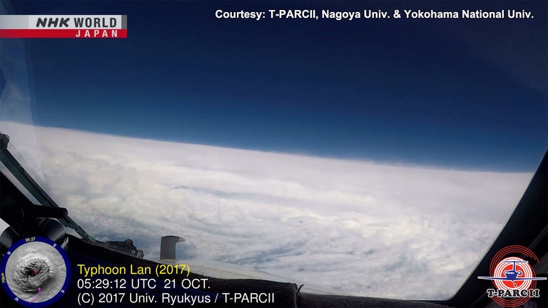
This video shows Tsuboki's first time entering an eye.
Emerging from thick clouds, there's suddenly a tranquil blue expanse.
I had goosebumps all over.
At first, it felt like trespassing in a
place that was off limits to humans.
It was like we had backstage
access to nature itself.
And the eye region is said to be very calm.
Certainly. Very few clouds, and almost no wind.
Not even a draft?
There's a gentle downdraft
which keeps the clouds away.
The eye is surrounded by a wall of thick storm clouds, 10 to 15 kilometers tall, known as the "eyewall."
The eyewall represents a border where the severe winds outside the eye, meet the powerful centrifugal force of the spinning center.
So, the winds in the eyewall clouds are extremely powerful.
The air inside the eye is about 10 degrees Celsius warmer than the air outside the eye.
Tsuboki made his fourth trip into a typhoon in September 2022.
It provided critical data.
The target was the massive Typhoon "Nanmadol."
We're inside the eye.
Tsuboki entered the eye region at an altitude of 45,000 feet, and released dropsondes.
The central atmospheric pressure, predicted to be 950 hecto-Pascals, was in fact lower: 940 hecto-Pascals.
So, this was probably a stronger typhoon than was forecast.
That creates a difference in peak wind speed
of around 10 meters per second.
In a strong typhoon that difference could
determine whether or not a building collapses.
So, direct on-site measurements are critical to understanding the true atmospheric
pressure and wind speeds in the eye region.
The central pressure was found to be 940 hectopascals, the fifth lowest measurement in Japanese recorded history,
and presumably indicating a typhoon of tremendous strength.
But, Tsuboki's data revealed even more.
Tsuboki is collaborating on typhoon research with Hiroyuki Yamada, a professor at the University of the Ryukyus.
What did you learn from the
data Tsuboki collected?
In Typhoon #14 "Nanmadol," the pressure was
extremely low, but the winds were not that strong.
This tells us that the
central pressure and wind speed don't always have the
one-to-one correspondence we'd expected.
In a typhoon with historically low central pressure, why weren't the winds correspondingly stronger?
Yamada speculates.
There may have been two layers of
eyewall clouds, in concentric circles.
The presence of an outer eyewall can
cause the original inner eyewall to weaken, which clearly seemed to be the case in
Typhoon #14 "Nanmadol."
Yamada believes the original inner eyewall may have been robbed of its strength by a newly-formed outer eyewall, dissipating the inner cloud wall, and weakening the winds there.
We still have a lot to learn about what causes this phenomenon.
Nevertheless, this tells us that a typhoon's central pressure alone is not a reliable measure of its strength.
Tsuboki's five-year collection of on-site data has given us a deeper understanding of the mechanisms that govern typhoon activity.
He believes typhoon forecasts will soon become much more accurate.
We now use measurements taken from airplanes.
This data must be combined with weather satellite
data, which tracks typhoons over longer periods.
In the future, I expect we'll shift to using
unmanned aircraft, so-called drones.
They could, for example, fly every day, constantly
collecting data. I expect that will become standard.
As weather technology improves, so too does our understanding of typhoons.
Still, our forecasting is imperfect.
But weather experts are hard at work making the forecasts as reliable as possible.
So, let's pay close attention to weather forecasts, and always remember: safety first.