


Typhoon
Hagibis
Aftermath
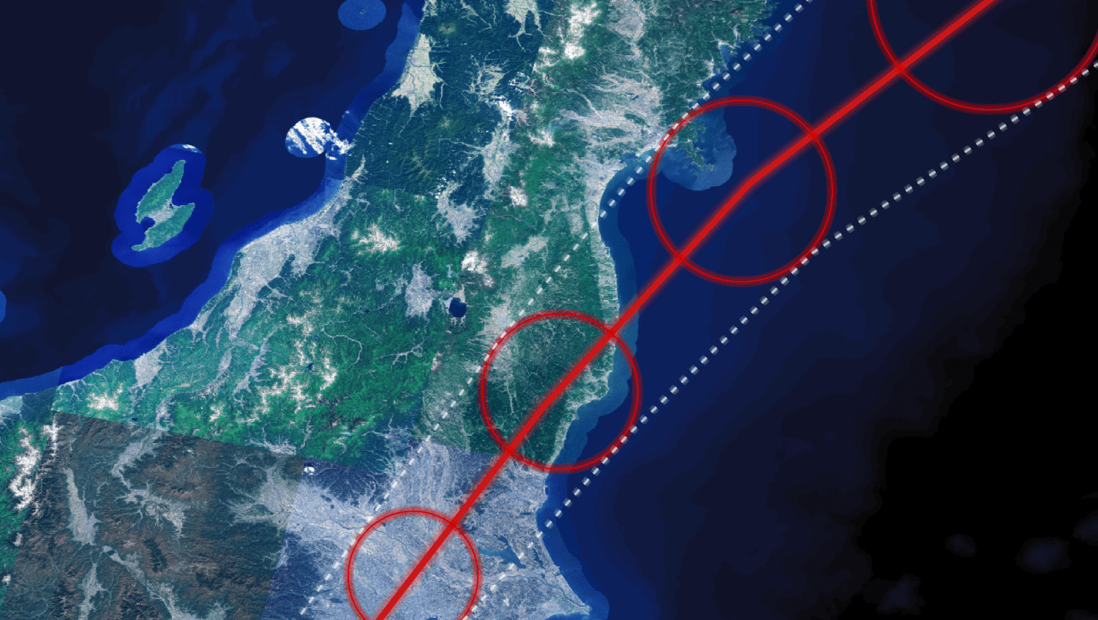
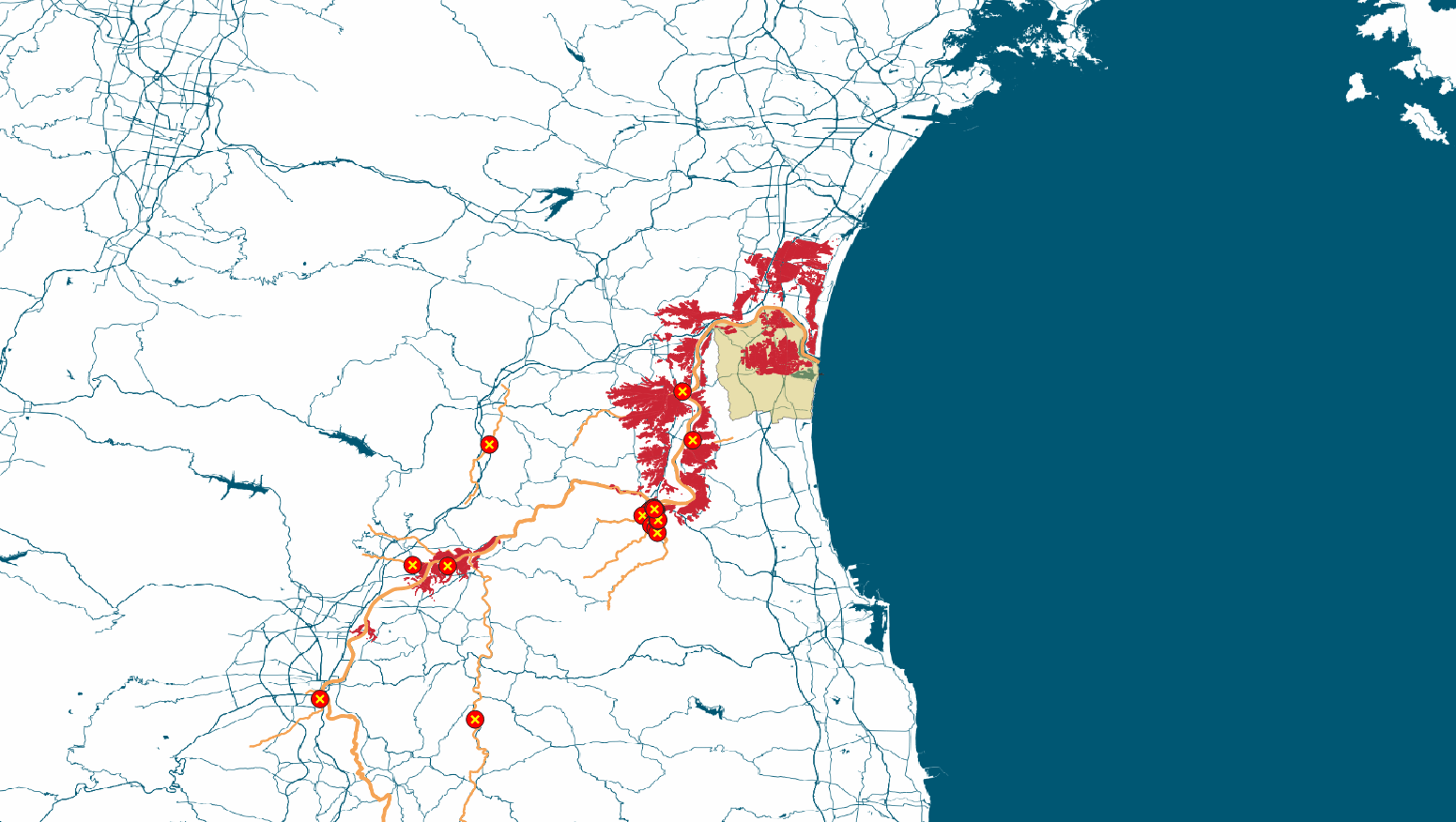
Typhoon Hagibis made landfall in the Izu Peninsula, near Tokyo, on the night of October 12, 2019. The storm cut through the eastern part of the island of Honshu, causing widespread destruction.
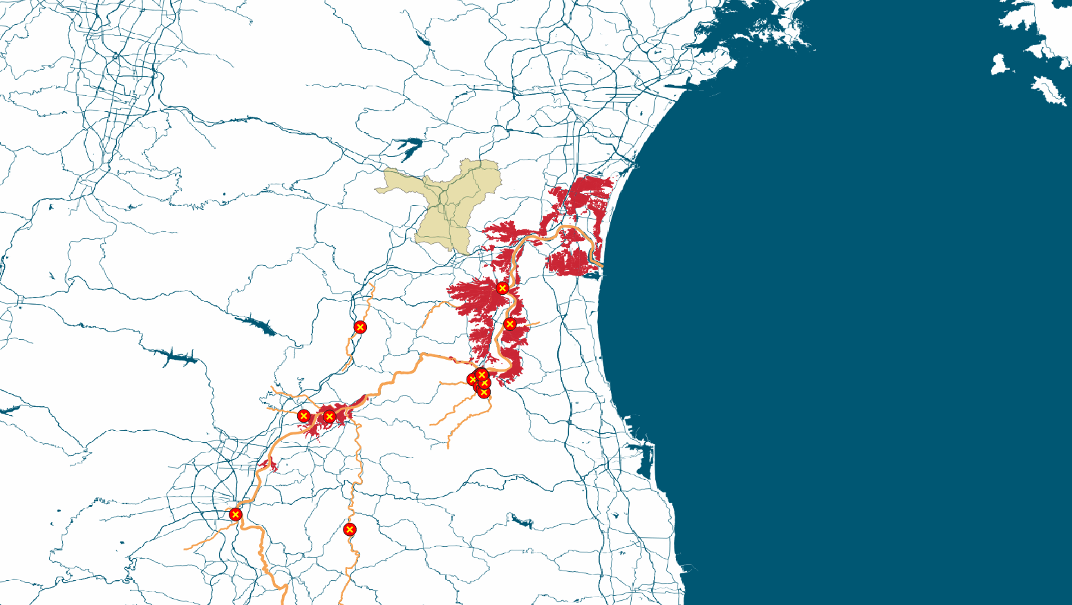
140 embankments along more than 70 rivers throughout the country broke as a result of record rain. 93 people were killed and more than 87,000 homes were heavily damaged.
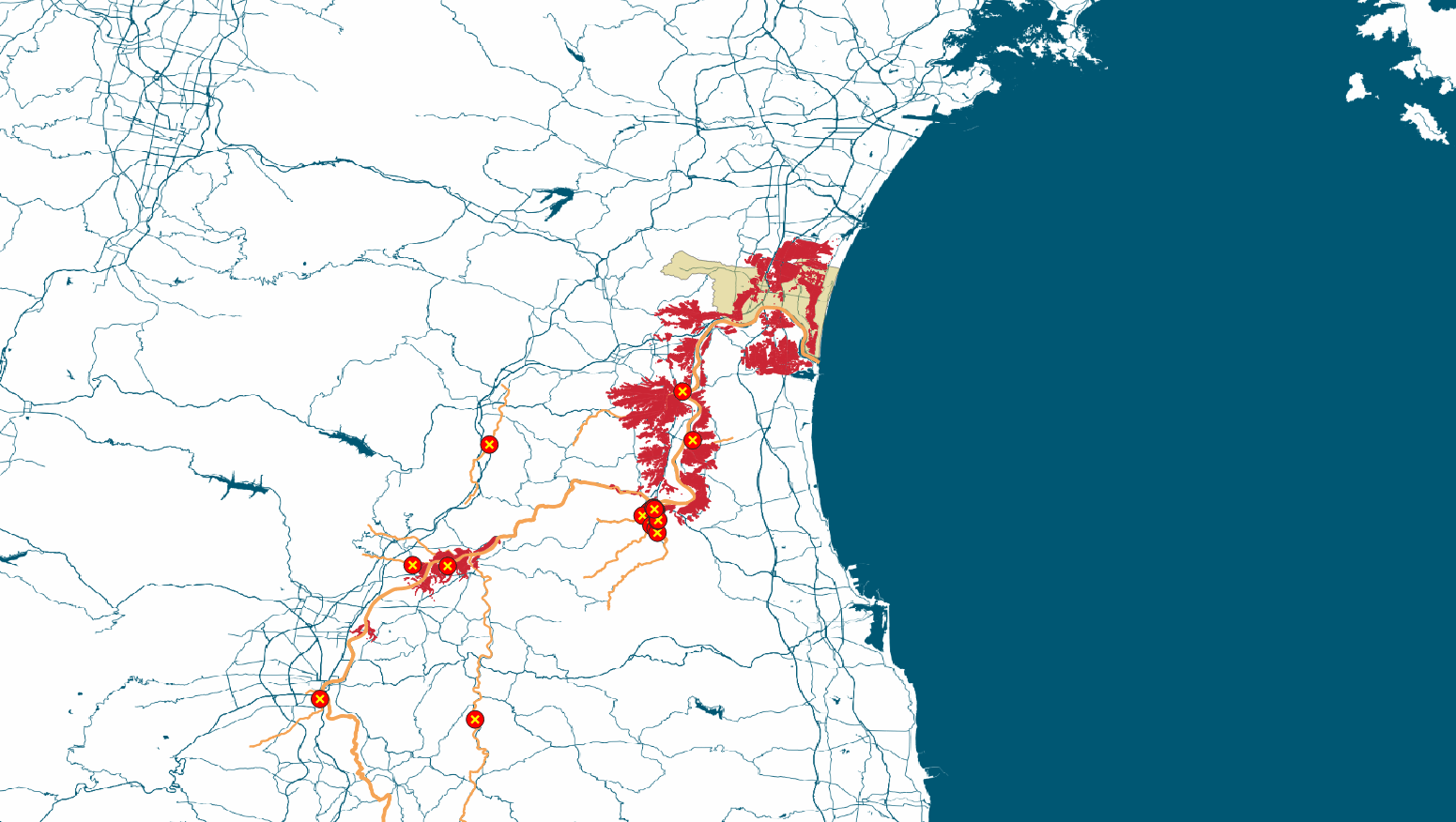
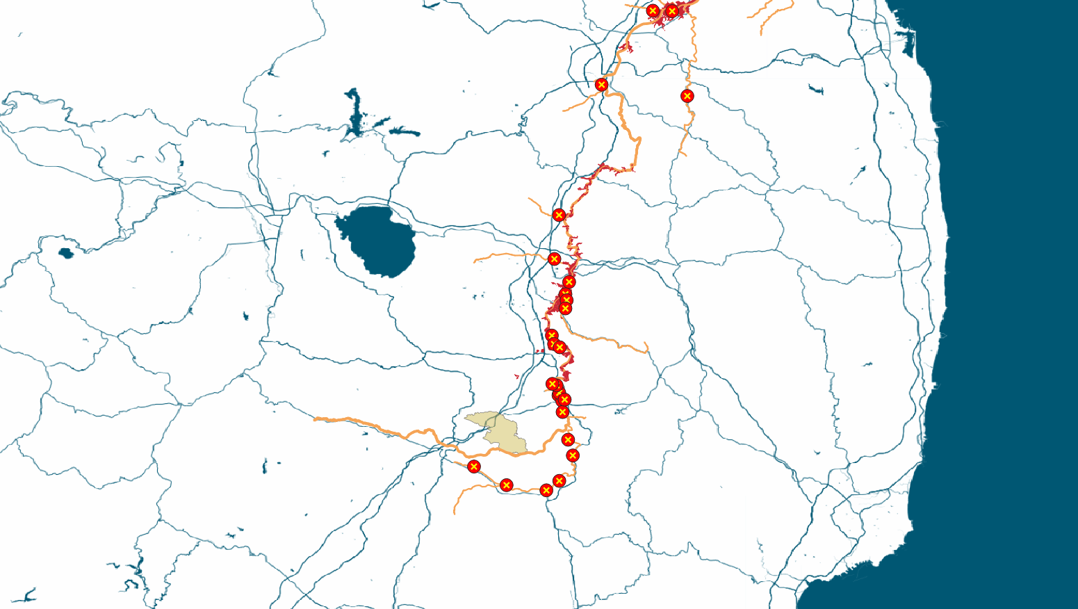
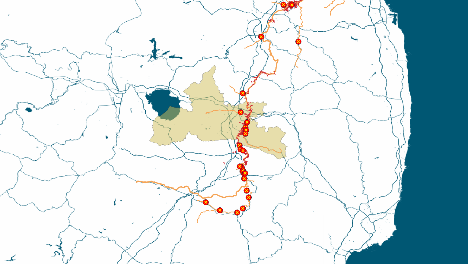
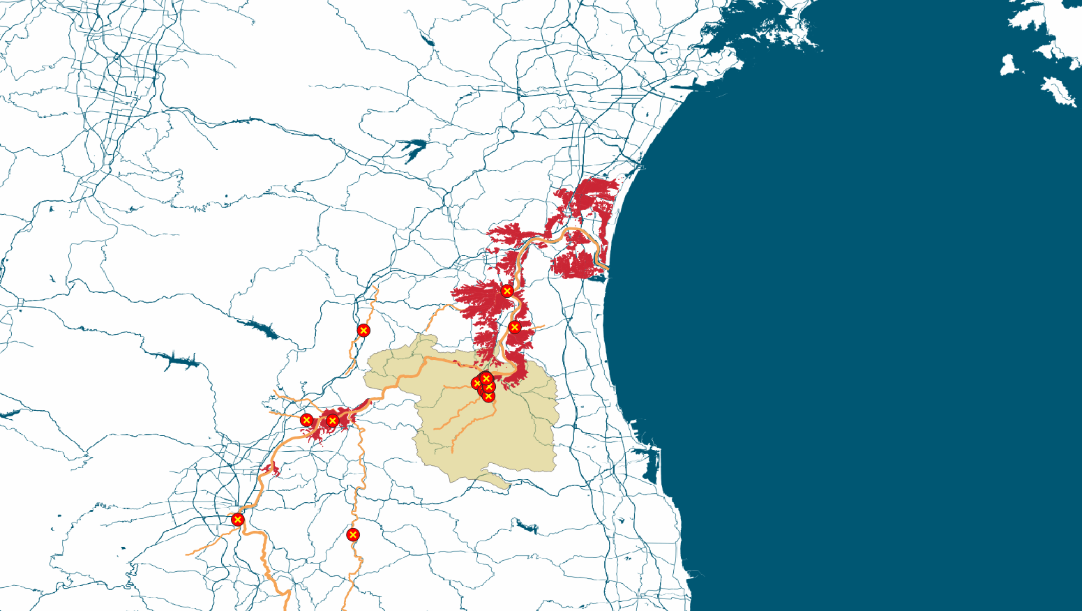
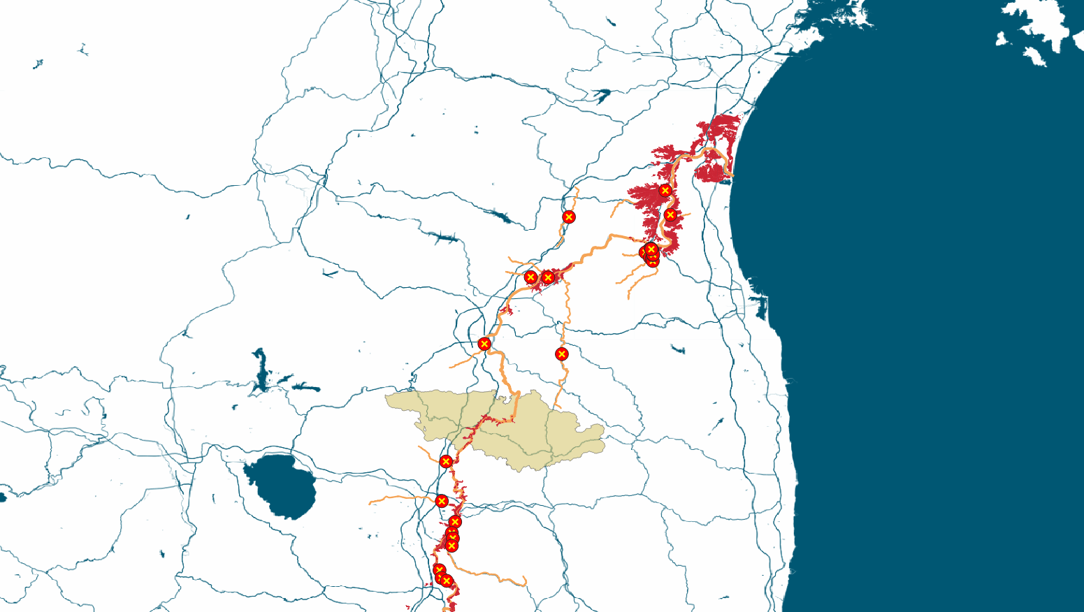
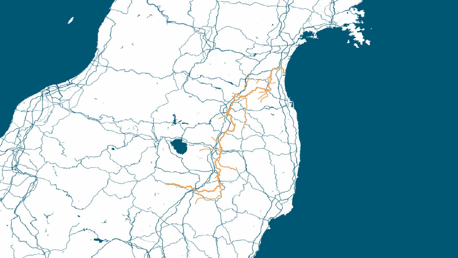
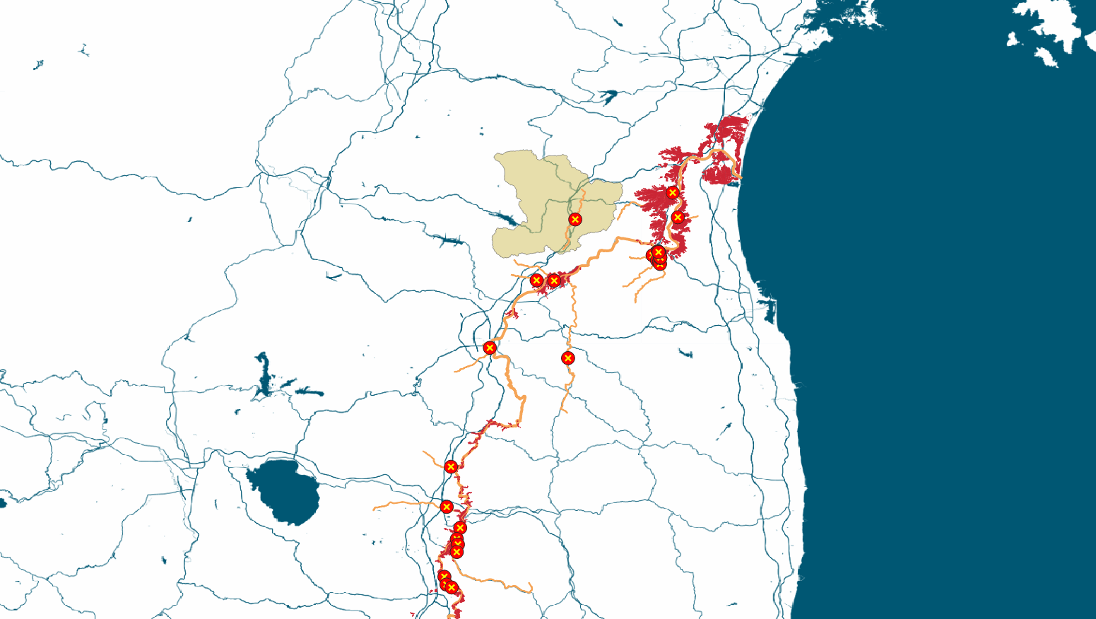
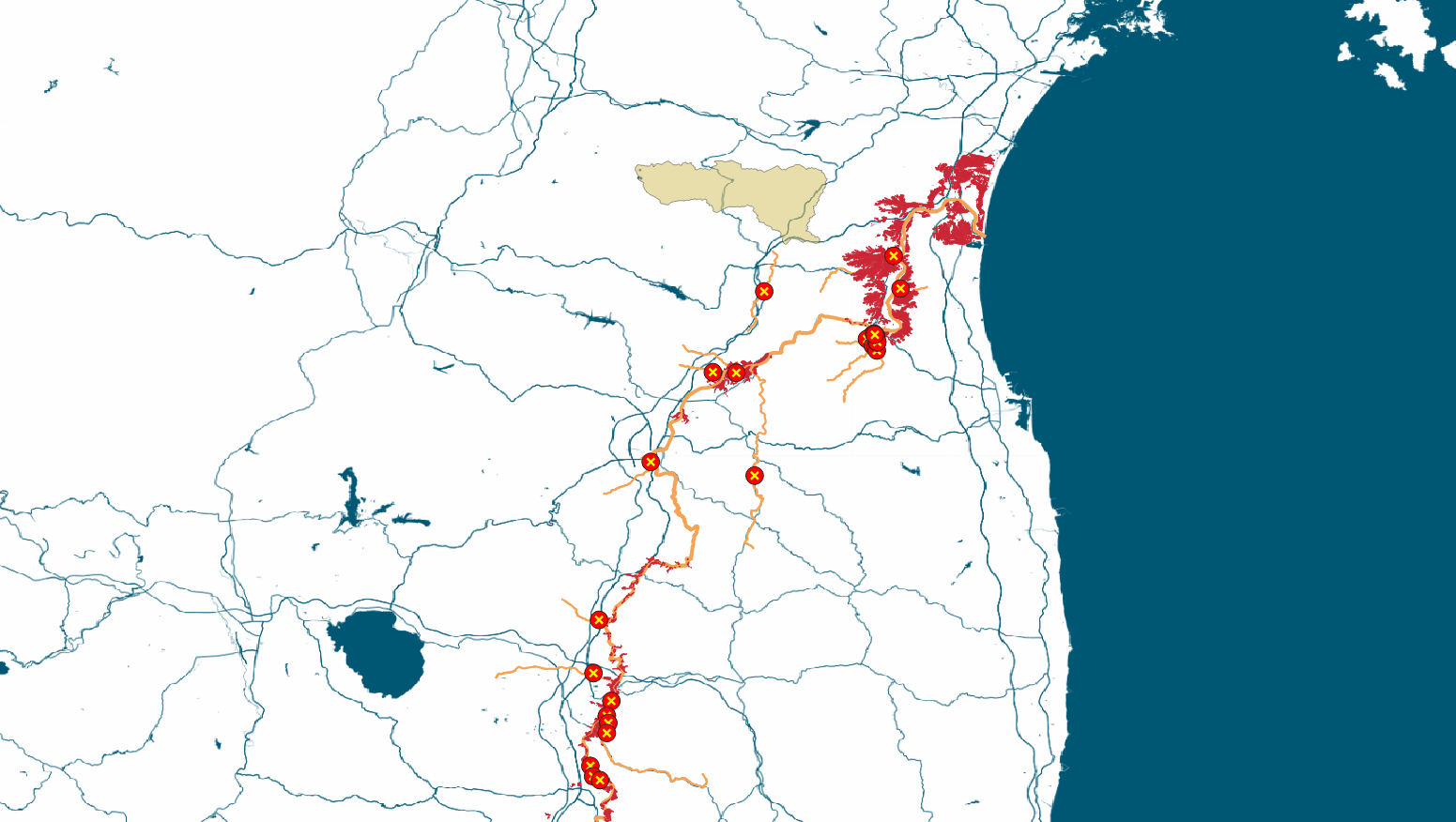
Along the Abukuma River
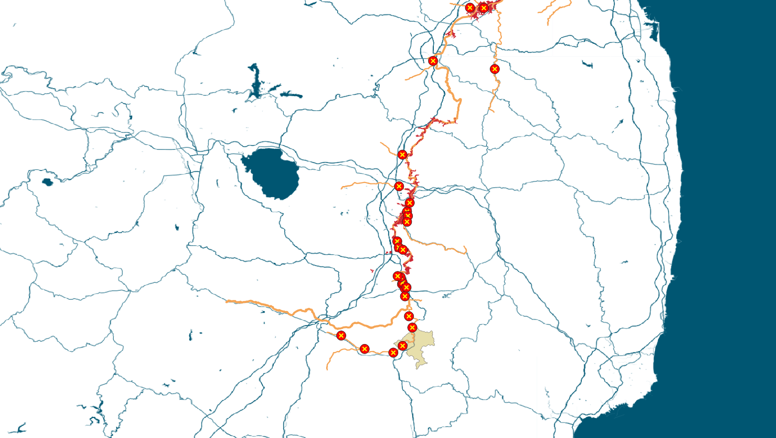
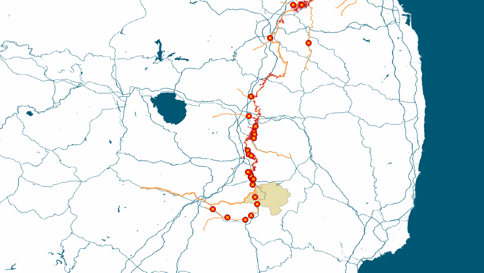
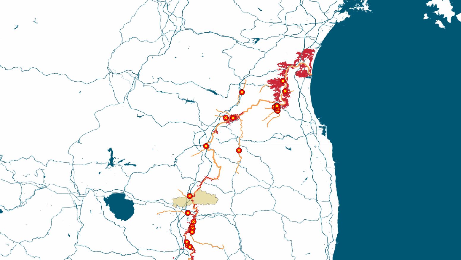
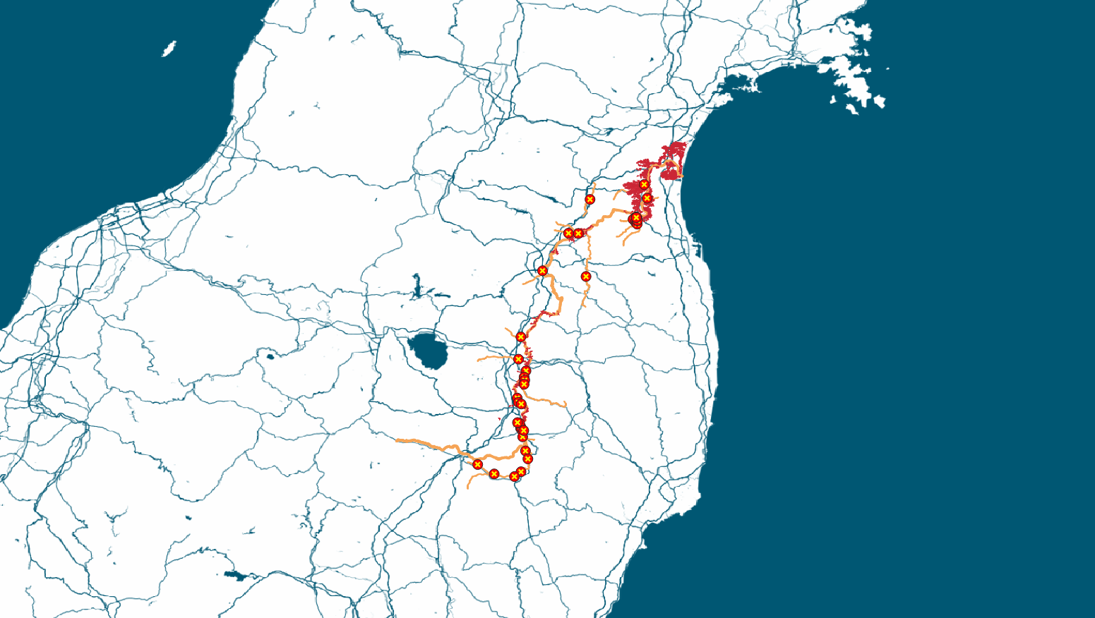
Some of the most severe damage was seen along the Abukuma River, which runs through Fukushima and Miyagi prefectures.
Levees at 47 locations collapsed along the river and 16 of its tributaries. More than 1,000 square kilometers were flooded.
Natori City
- Houses damaged217
Iwanuma City
- Injured1
- Houses damaged46
Watari Town
- Houses damaged66
Shibata Town
- Injured1
- Houses damaged1209
Murata Town
- Houses damaged200
Ogawara Town
- Houses damaged516
Kakuda City
- Dead1
- Injured4
- Houses damaged1562
Marumori Town
- Dead10
- Injured2
- Houses damaged1237
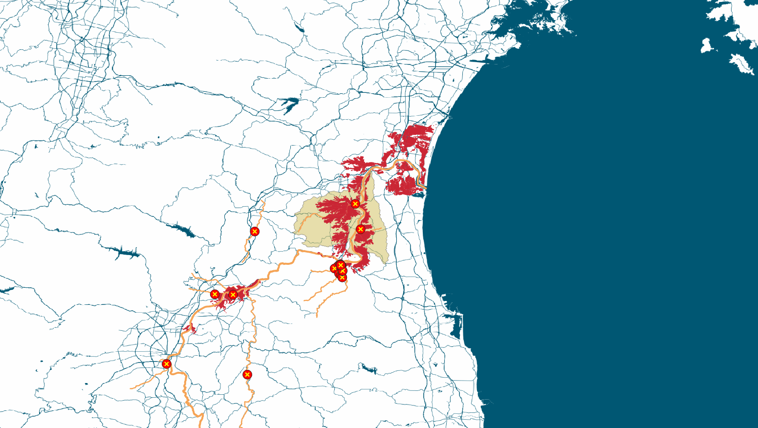
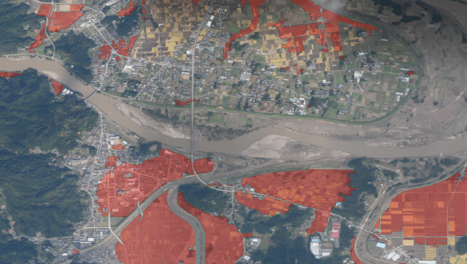
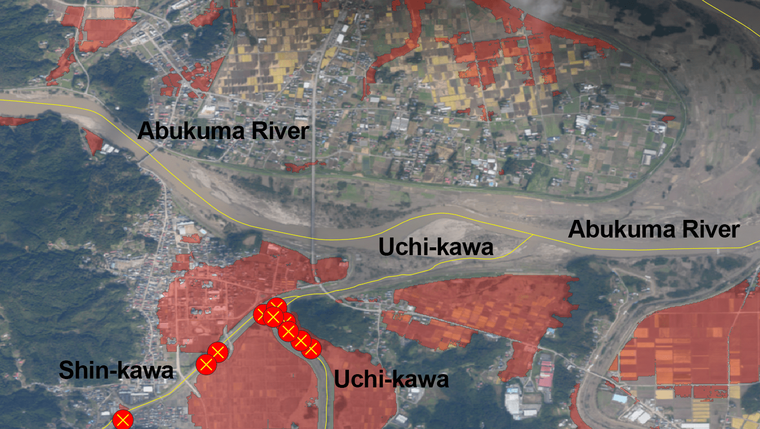
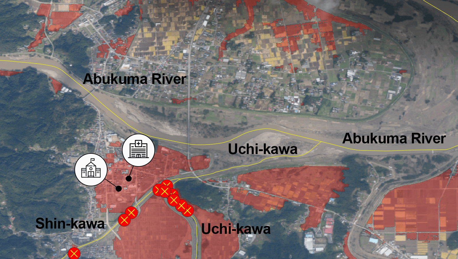
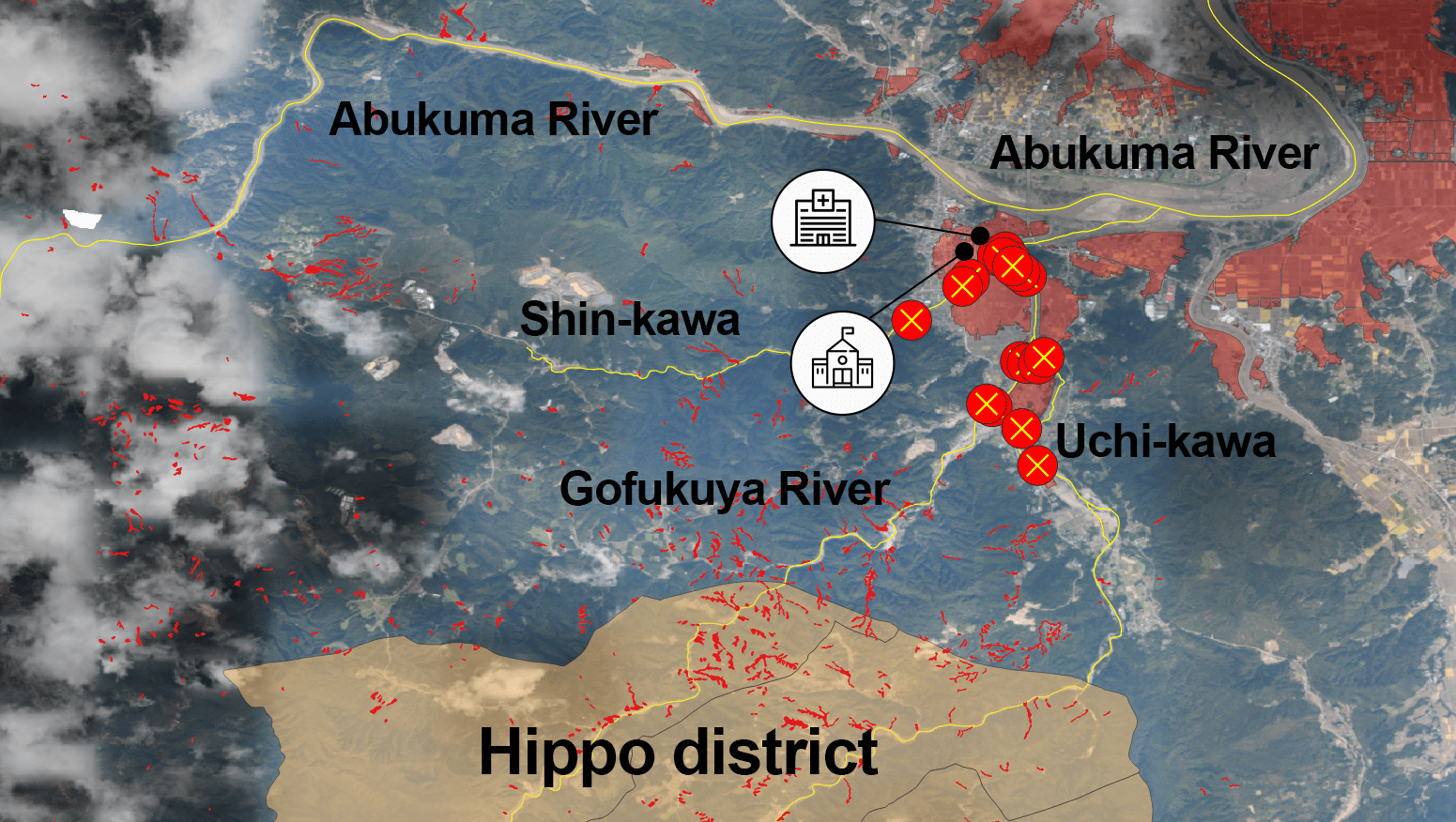
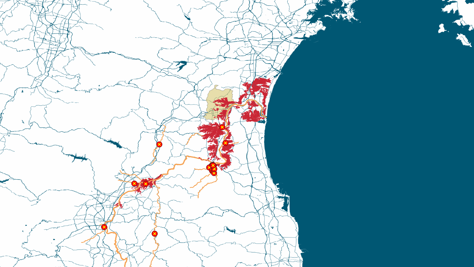
Backwater Phenomenon
The typhoon claimed 10 lives in Marumori Town. This is the largest death toll of any community along the Abukuma River. Large parts of the town's central area were inundated.
Embankments were ruptured along the Shin-kawa and Uchi-kawa rivers, tributaries of the Abukuma.
This is believed to have been caused by the "backwater phenomenon." This is when a river is filled with rain water, blocking the flow of its tributaries and in turn causing their water levels to rise.
The town office was flooded and isolated for two days. Marumori's sole general hospital was also inundated, leading to medical exams being suspended for 16 days.
Landslides cut off access to the town's mountainous areas. Some communities in the Hippo district were isolated for over a week.
Zao Town
- Dead1
- Houses damaged39
Shiroishi City
- Houses damaged394
Date City
- Injured12
- Houses damaged973
Fukushima City
- Injured8
- Houses damaged1225
Kawamata Town
- Houses damaged113
Nihonmatsu City
- Dead2
- Injured2
- Houses damaged287
Otama Village
- Houses damaged6
Motomiya City
- Dead7
- Houses damaged986
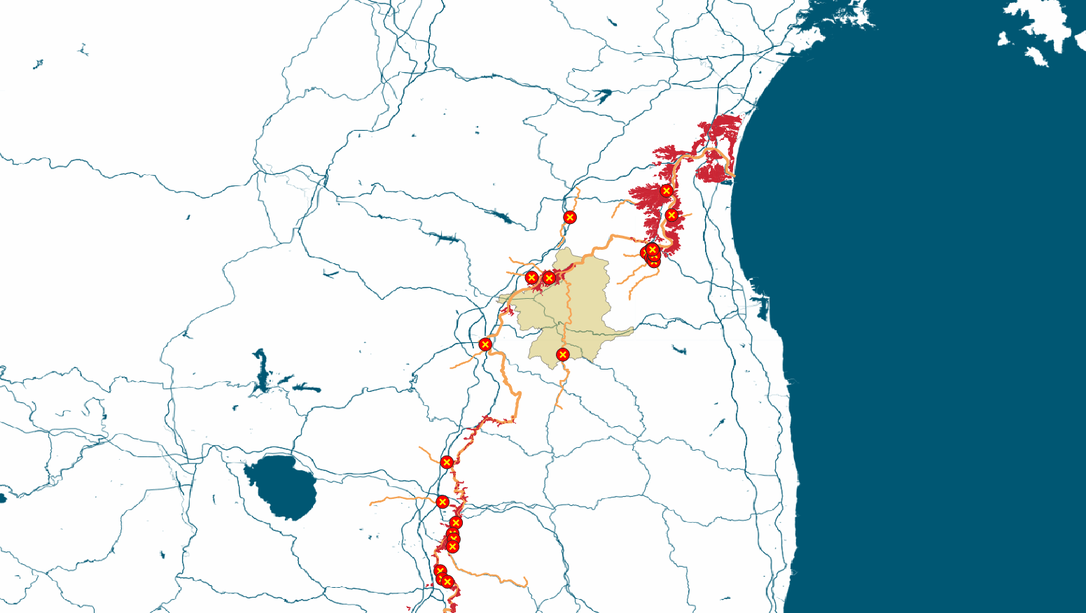
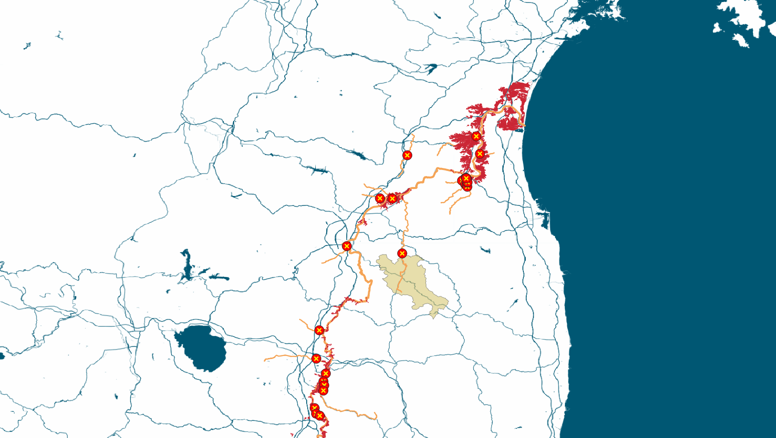
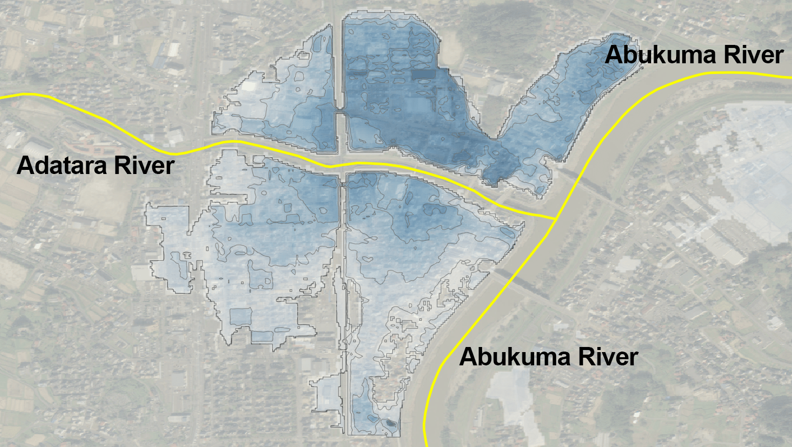
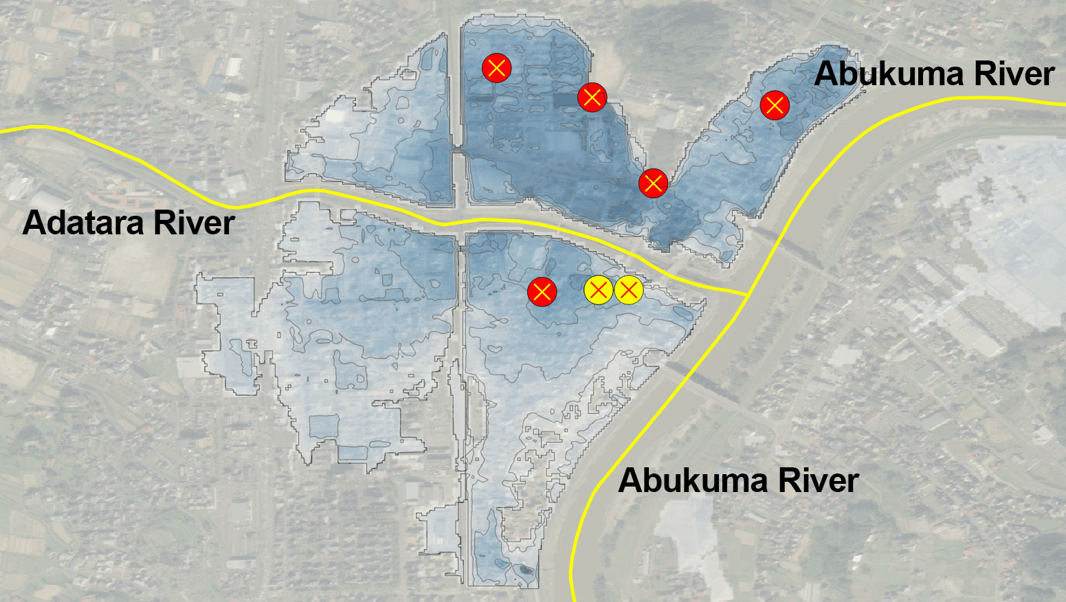
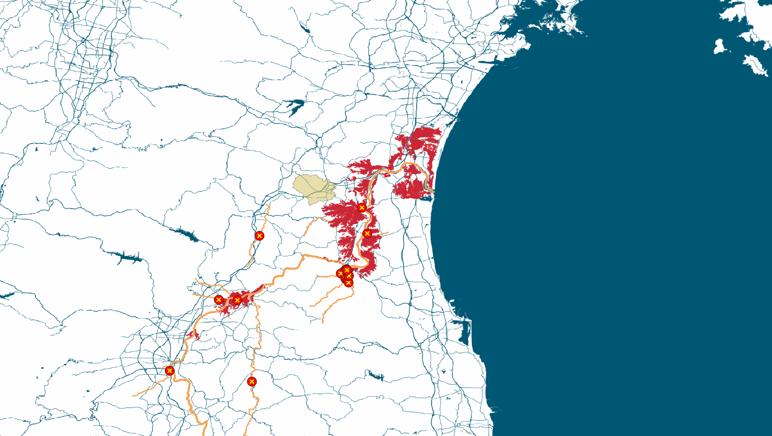
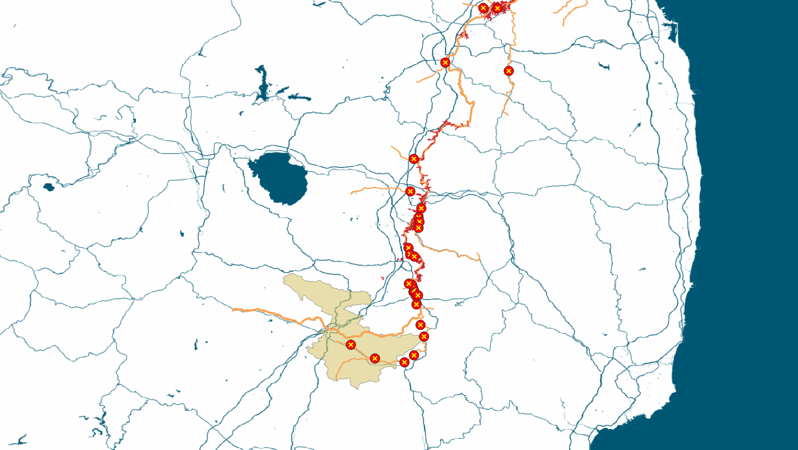
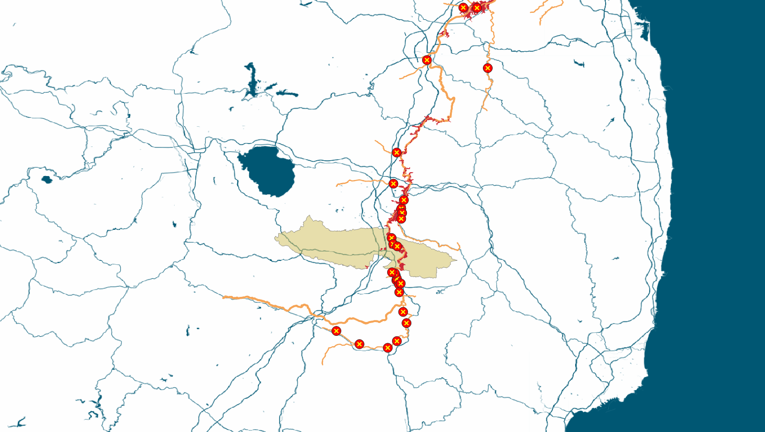
Dead on the 1st Floor
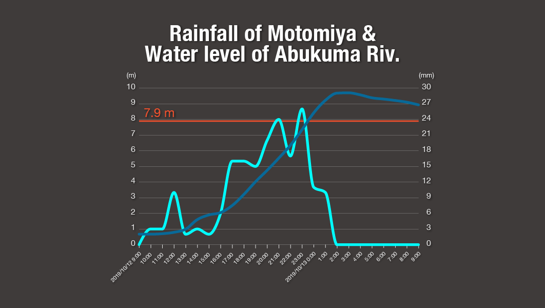
Some estimates show that flooding in an urban area of Motomiya City, where the Abukuma meets the Adatara, reached up to 4.8 meters.
Seven people were killed, with five found on the first floor of their homes. It is believed they were left with no time to evacuate due to rapidly rising water levels.
Even after rains subsided, water levels continued to rise. At around 1 a.m. on October 13, both rivers overflowed and water flowed rapidly into the city.
Miharu Town
- Houses damaged16
Koriyama City
- Dead6
- Injured1
- Houses damaged7240
Sukagawa City
- Dead2
- Houses damaged903
Kagamiishi Town
- Injured1
- Houses damaged95
Tamakawa Village
- Houses damaged62
Yabuki Town
- Houses damaged20
Izumizaki Village
- Houses damaged17
Nakajima Village
- Houses damaged13
Ishikawa Village
- Houses damaged535
Asakawa Town
- Houses damaged26
Tanagura Town
- Injured2
- Houses damaged6
Shirakawa City
- Dead2
- Houses damaged12
Nishigo Village
- Houses damaged23
On October 29, the government designated the disaster as "severe" and "extraordinary" as defined in the disaster recovery law. This is the second time the designation has been used, following the strong earthquakes that hit Kumamoto Prefecture in 2016.
Two months have passed since the typhoon. Nearly 1,500 people continue to live in evacuation centers.
Sources
Maptiles & Geospatial Information by Geospatial Information Authority of Japan (GSI); Maptiles by MIERUNE, under CC BY. Data by OpenStreetMap contributors, under ODbL; Integrated Disaster Information Mapping System (DiMAPS) by Ministry of Land, Infrastructure, Transport and Tourism (MLIT); Water Information System by MLIT; Cabinet Office; Fukushima Prefecture; Miyagi Prefecture
