How much rain?
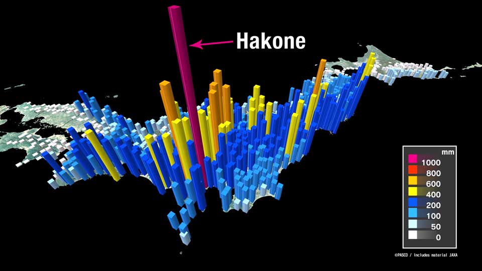
So, how much rain did Hagibis bring? The bars in the graphic below indicate the total rainfall. Over 100 observation spots, from the Kii Peninsula all the way up to the Tohoku region, experienced unprecedented rainfall.

Hakone, which is known for its hot springs, experienced the heaviest. The area received over a meter of rain -- three times more than the typical October. Most of the water came down in a short period of time, with 922.5mm falling in 24 hours, setting a new national record.
Why was the rain so bad?
Typhoons in general produce huge amounts of rain as they bring moisture from the tropics. That's why the Pacific side of Japan, where typhoons frequently hit, see much more rainfall than the opposite side of the country. However, even compared to other typhoons, Hagibis dumped extraordinary amounts of water.
What made Hagibis so extreme? Three factors were involved:
1. Intensity
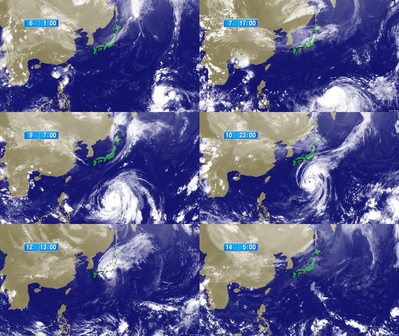
Hagibis was one of the strongest tropical systems on earth this year. It underwent a rapid intensification, resulting in its central pressure dropping from 992hPa to 915hPa in 24 hours. This is the ninth-biggest pressure drop ever recorded in a typhoon.
The intensification was caused by the warm waters off the Mariana Islands. This ocean area is infamous among meteorologists, as past typhoons that developed in the area frequently caused significant damage in Japan. The area is far from any land masses and the water is warm, so there is almost nothing to weaken the storms.
In addition, the sea surface temperature over the area was about 2 degrees Celsius warmer than normal. That fed more moisture into the typhoon, making Hagibis an even more significant rain maker.

2. Speed
Hagibis was a slow-moving typhoon with a forward velocity of only about 30kph. Fall typhoons tend to move faster as the storms interact with the jet stream over the country. But the jet stream was present to the north this time, making Hagibis move slowly.
3. Size
On top of the speed, Hagibis was categorized as a large typhoon, as the area of tropical-force winds was over 1,400km in diameter. Torrential rain started to fall more than a day before it reached land.
With the large size and slow movement, moist winds continued to flow in. That led to record-breaking rainfall in many places.
Super typhoons on the rise
Experts say the frequency with which we see storms as strong as super typhoons will increase in the near future. The ocean is expected to heat up by 2 to 3 degrees Celsius by the end of this century, and that will allow powerful storms to form more frequently over the northwestern Pacific. Some say super storms with pressures of 860hPa and gusts of up to 320kph are possible.
When it comes to typhoons, Japan is one of the best-prepared countries in the world, but we may have to reconsider our countermeasures, both in terms of infrastructure and preparation.

